

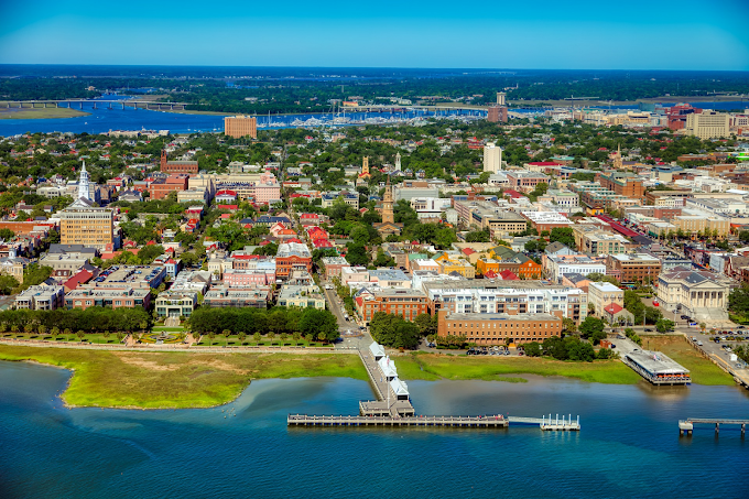
The historic city of Thiruvananthapuram is the capital of Kerala with Kerala Legislative Assembly and the Government Secretariat standing in it as two land marks. Sree Padmanabha Swamy temple is a towering monument around which the old Thiruvananthapuram city was built. The Thiruvanthapuram International airport is located only 6 km from the centre of the State Capital
The name 'Thiruvananthapuram' means Thiru Ananda Puram, the abode of the sacred snake-God Ananthan , on whom Vishnu , the God of Preservation is imagined as reclining. The old name Trivandrum is an anglicized form of the word Thiruvananthapuram. Thiruvananthapuram city and several other places in the district, occupy an important place in ancient tradition, folklore and literature of the State. South Kerala, particularly Thiruvananthapuram district, had a political and cultural history in the early past, which was in some respect independent from that of the rest of Kerala.
Thiruvananthapuram, the southern most district of Kerala State is situated between north latitudes 8° 17' and 8° 54' and east longitudes 76° 41' and 77° 17'. The southern most extremity, Kaliyikkavila, is only 54 kms away from Kanyakumari (Cape Comerin), the tip of India's land mass. The district stretches 78 kms. along the shores of the Arabian sea on the west, Kollam district lies on the north with Thirunelveli and Kanyakumari districts of Tamil Nadu on the east and the south respectively.
The district can be divided into three geographical regions; highlands, midlands and lowlands. Chirayinkeezhu and Thiruvananthapuram taluks lie in the midland and lowland regions, while Nedumangad taluk lies in midland and highland regions and Neyyattinkara taluk stretches over all the three regions. The highland region on the east and north-east comprises of the mountains of the Western Ghats and this area is ideal for major cash crop plantations like rubber, tea, cardamom and other spices. Timber trees like teak, veetty (rose wood), etc are grown in this region. The midland region, lying between the Western Ghats and the lowlands, is made up of small and tiny hills and valleys. This is an area of intense agricultural activity. This region is rich in produces like paddy, tapioca, spices and cashew. The lowland is comparatively narrow, comprising of rivers, deltas and seashore. This area is densely covered with coconut palms. The Ghats maintain an average elevation of 814 meters and Agastyakoodam, the southern most peak in the Ghats, is 1869 meters above sea level. It figures in the popular mythology connected with Agastyamuni, the sage. Mookkunnimala near Thiruvananthapuram (1074 meters) is an important health resort in the district.


0 Comments